


Contributing Authors: Lauren Neitzke Adamo (RCEI Affiliate), Jim Wright (RCEI Affiliate), James Bourke, Ken Miller (RCEI Affiliate), Sean Kinney, Roy Schlische
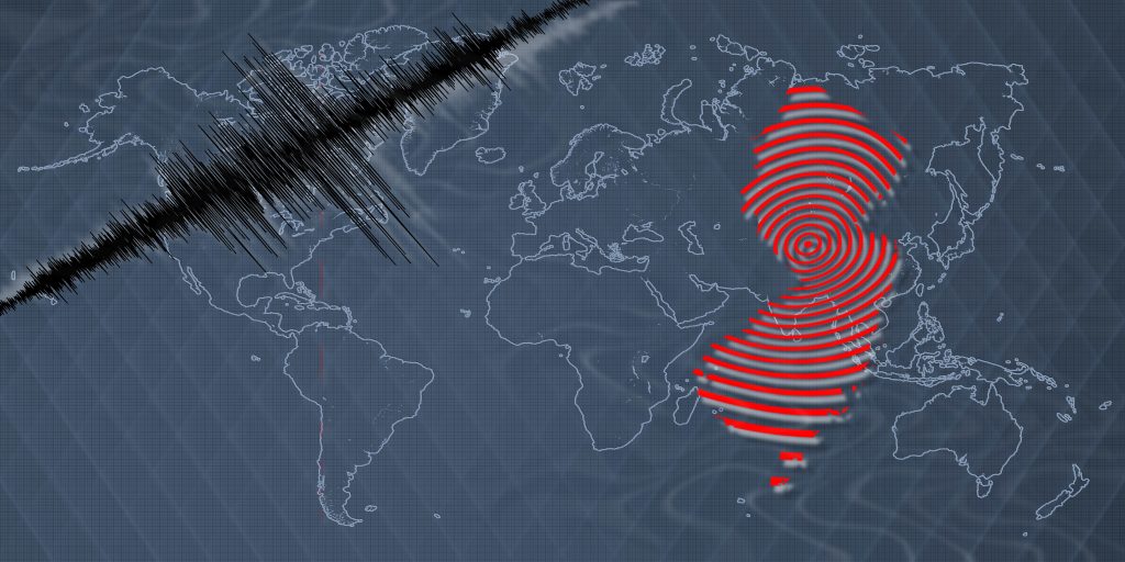
As soon as the shaking subsided on Friday, April 5 from a rare Magnitude 4.8 Earthquake in New Jersey, geologists in the Department of Earth and Planetary Sciences (EPS) at Rutgers University-New Brunswick immediately went to work to deconstruct what happened.
They consulted each other and checked the national Earthquake Hazards program run by the United States Geological Survey (USGS), which actively monitors and reports on earthquakes worldwide, for the initial location and magnitude of this earthquake.
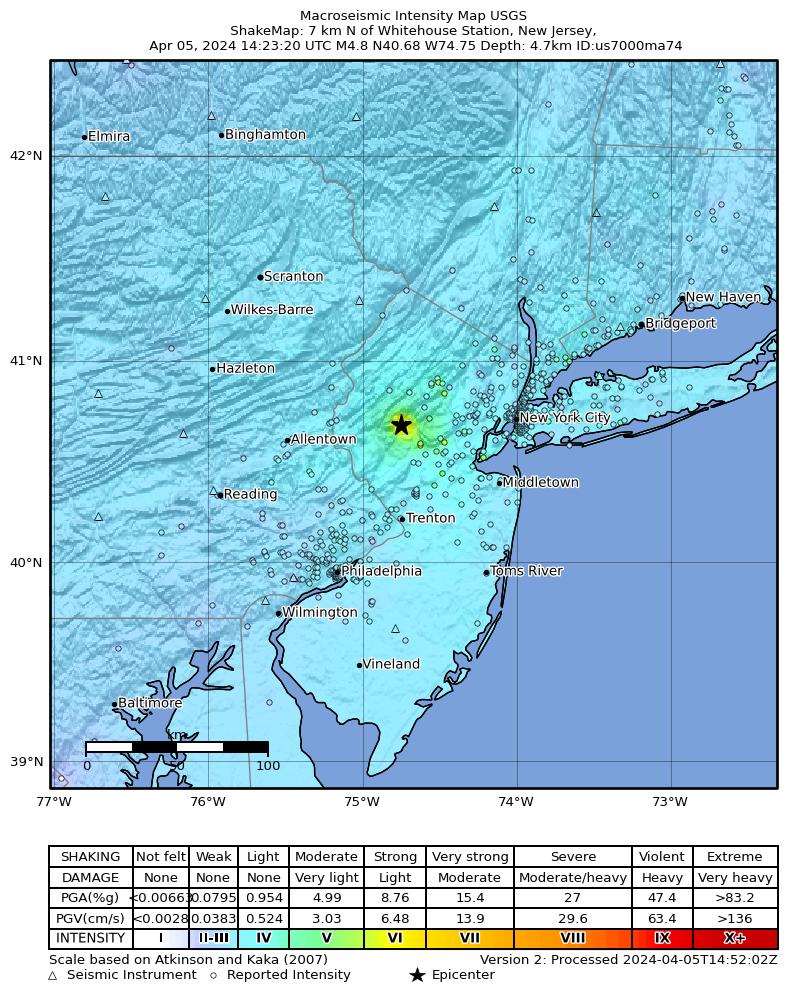
Reports indicate that there was moderate to light shaking observed during the event and people may have seen or felt objects inside houses or outside shake or fall down (USGS shake map image on the left). While the overall economic loss is very minimal, reports of damage to some historic structures such as Taylor’s Mill in Readington Township, NJ near the epicenter of the earthquake are emerging. Prior to last week, the strongest earthquake with an epicenter recorded in New Jersey occurred on August 23, 1938 at 5:04 am. This earthquake originated southeast of Trenton, and it was felt by residents as far north as Jersey City and as far south as northern Delaware. Similar to the April 2024 earthquake, damage was largely confined to dishes and glassware being broken when shaking knocked them from shelves.
The USGS rated the earthquake as a 4.8 magnitude on the Richter Scale, and mapped the epicenter near Whitehouse Station, NJ at a depth of 4.7 km. The Ramapo Border Fault system runs through this region and regularly experiences earthquakes, but they are generally much smaller than the one that occurred on April 5th. (i.e. magnitude 3 or less). The strength of the crust on the East Coast allows the energy released from an earthquake to travel much farther distances, and is the reason the shaking was felt over a wider area than similar sized, and much more frequent, earthquakes on the West coast. USGS data show reports of shaking from this event as far south as Baltimore, Maryland, and as far north as Springfield, Massachusetts.
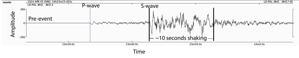
Image below shows seismograph data from the 4.8 magnitude earthquake that occurred on April 5th, 2024. The P-wave is when the earthquake is first detected on a seismometer, but no shaking is felt yet. The S-wave records when the shaking, that lasted approximately 10 seconds, started and was recorded.
History of the Ramapo Border Fault System
Most earthquakes occur along plate boundaries. New Jersey is located on the passive edge of the continent, meaning there is no active or current plate tectonic boundary within the state. However, this was not always the case. The Ramapo fault system was first developed ~440 million years ago by collisions during a Himalayan-scale mountain-building event that formed the Taconic Mountains. This was part of the assembly of the supercontinent Pangea. These faults were later reactivated, or started moving again, during the breakup of Pangea from 230 to 198 million years ago, which produced a large series of rift basins that stretched along the modern Eastern North American Margin from the Canadian Maritime provinces to the southeastern United States. Large lakes formed in these basins, including the Newark Rift Basin here in New Jersey, depositing the sediments and rocks found beneath the Rutgers-New Brunswick and Newark campuses. Relevant to Friday’s earthquake is that movement on this ancient fault system still occurs.
The Ramapo Border Fault system extends from southern New York through New Jersey into Pennsylvania for about 300 km (185 miles). The earthquake apparently occurred on the Flemington Fault which is part of the Ramapo Border Fault System. The movement that still occurs on faults in this system are produced by intraplate stresses, which poses the largest earthquake threat to the immediate region; however, the magnitudes of these earthquakes are smaller than those on the west coast which occur along plate boundaries. This appears to be the largest earthquake on the fault since 1938 near Trenton.
Just Another Normal Day for Plate Tectonics
Although exciting and novel to east coast residents, the tectonic events on Friday, April 5th represent just another day of plate tectonics. According to the USGS, 67 earthquakes of magnitude 2 to 6.8 were observed worldwide on April 5th, 22 of which occurred in the United States. The New Jersey earthquake was the largest event recorded in the United States that day, followed in size by an earthquake in Belden, CA. Worldwide, the USGS recorded 5 earthquakes with magnitudes between 3 and 4, and 25 earthquakes with magnitudes between 4 and 5 with the largest occurring in southern Mexico and Taiwan. All these earthquakes occurred along active tectonic plate boundaries, making the event in New Jersey even more interesting in that it was the only significant one to occur away from an active plate tectonic boundary.
New Seismometers Advance Study of the Fault System
Since the main event, multiple aftershocks have been recorded with magnitudes between 2.0 and 3.8. The largest of which occurred at 5:59 pm on Friday, April 5th with a magnitude of 4.0. Since the initial event, over 40 earthquakes above 1.0 magnitude have been reported from the USGS in New Jersey. Scientists cannot accurately predict when and how many aftershocks may occur after an earthquake but they place the likelihood of further aftershocks of a magnitude 3 earthquake occurring 38%, magnitude 4 as 9%, and a magnitude 5 as <1%. Residents can expect aftershocks to continue occurring at low magnitudes, likely unfelt by the public, for a time that may range from weeks to months.
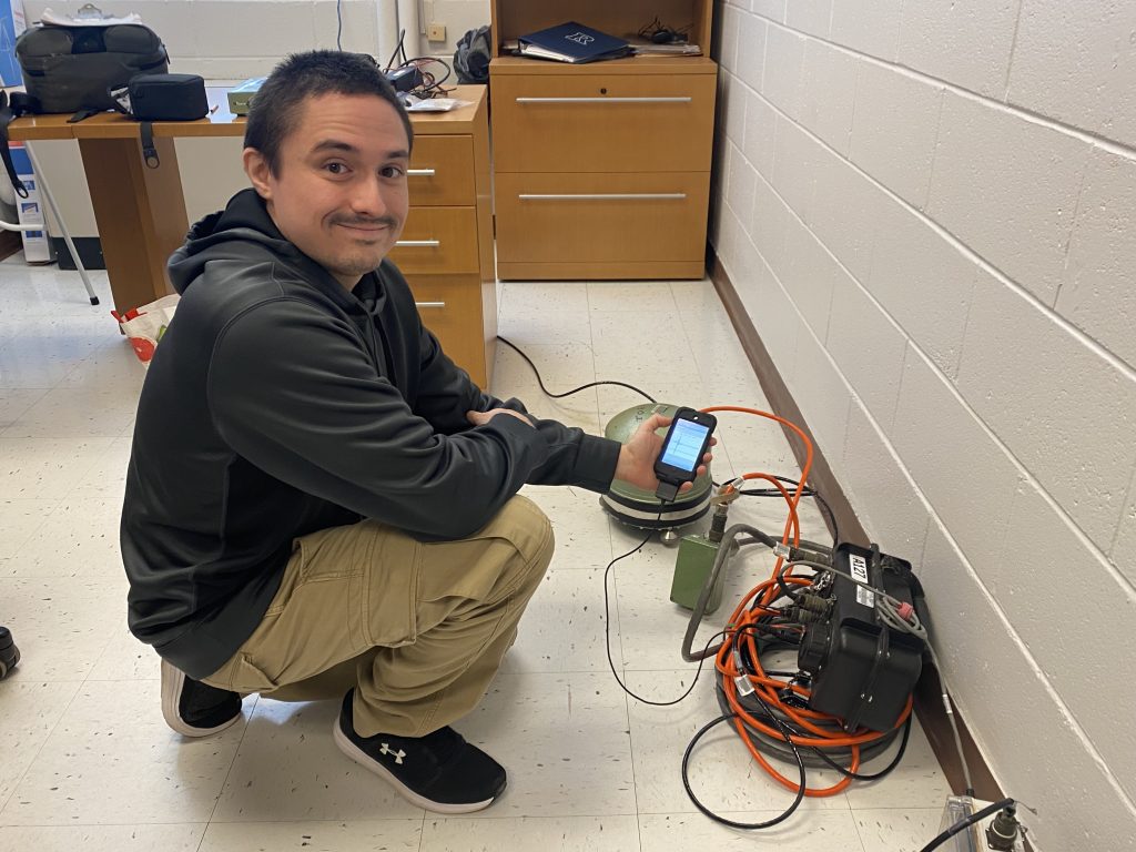
James Bourke (image on left), a postdoctoral research fellow and seismologist in EPS, recently retrieved an unused seismometer and had it sitting in his office. At home when the earthquake hit Friday morning, he immediately traveled back to the department on Busch Campus and activated the seismometer in hopes of recording aftershocks and has monitored seismic activity since late Friday afternoon. Bourke confirms that the device was recording during several aftershocks with magnitudes between 1 and 3 over the weekend. Bourke plans to permanently install the seismometer on the Busch Campus to record seismic activity over the next few months. The Department of Earth and Planetary Sciences will create a live stream link, so users and the public can view the seismic activity recorded on campus in real-time.
Scientists have long known that earthquakes can occur along this fault system, but it has not received much attention as it does not impose an immediate short-term or long-term threat to residents or infrastructure. The seismic events of April 5th have brought new attention to the area and national and local scientists are actively working to deploy a series of seismometers around New Jersey to continue monitoring for aftershocks from the April 5th earthquake. This data will also map the complexities of the Ramapo fault system and help geologists better understand the potential for future earthquakes in the area.
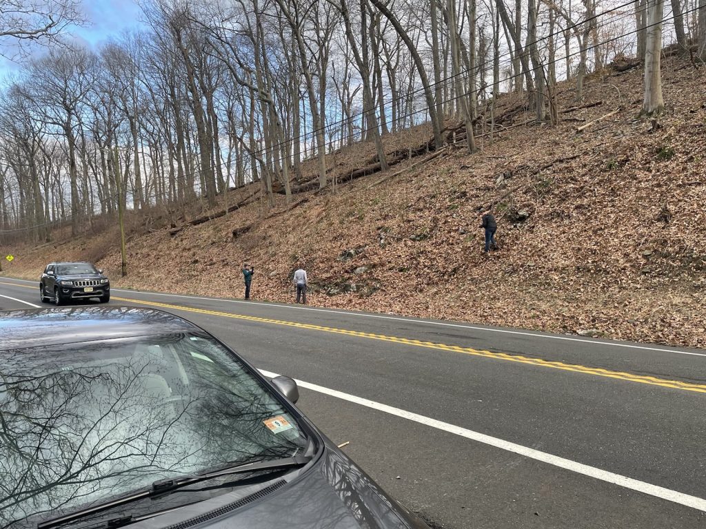
Sean Kinney and David Tibbits, Rutgers University Researcher and Graduate Student, respectively, traveled to the area near the epicenter to search for fractures, slip surfaces, and other signs of earthquake movement when the magnitude 3.8 aftershock hit (image on right). Kinney and Tibbits report that they heard what sounded like a loud gunshot before they felt the ground shake again and immediately realized they were experiencing an aftershock near the site of the original epicenter. Their ongoing work is focused on estimating the timing of the rock deformation associated with the break up Pangea both within the Newark Rift Basin and elsewhere on the Eastern North American Margin in collaboration with researchers at Columbia and Westchester Universities and Middlebury College. All of which new research and data from this and future earthquakes in New Jersey can help reveal new findings and understandings.
Rutgers Earth and Planetary Sciences Faculty Speak About the Earthquake to the News
Check out what Rutgers faculty and researchers had to say about the Earthquake to the public and news reporters.
Graduate Student Roberto Masis speaks to Univision in Spanish.
Professor Ken Miller interviewed and quoted in Forbes, the Daily Mail, Scientific American, Times Now, and MSN.
Professor Greg Mountain interviewed and quoted in Wired.
Teaching Professor, Lauren Neitzke Adamo interviewed on News12 and NJ 101.5.
This article was originally published by the Rutgers Department of Earth and Planetary Sciences.